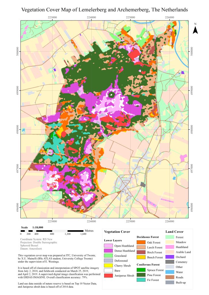
The end product, a vegetation cover map of Lemelerberg and Archemerberg in the Netherlands.
Using ArcGIS, I produced a vegetation cover map of a rural area in the Netherlands as part of a master course, “Mapping and Monitoring for Natural Resource Management” that I took in 2019 during my bachelor at University College Twente.
With so many different types of vegetation and land cover to portray, the main challenge (after a laborious classification undertaking of satellite imagery using information from fieldwork) was choosing an appropriate colour palette to ensure quick and accurate interpretation of the map. I opted for less saturated hues for the surrounding land cover as this information was not the focus of the map, and more saturated hues for the vegetation cover. I additionally distinguished coniferous and deciduous forests from one another by using varying green and orange hues, respectively.
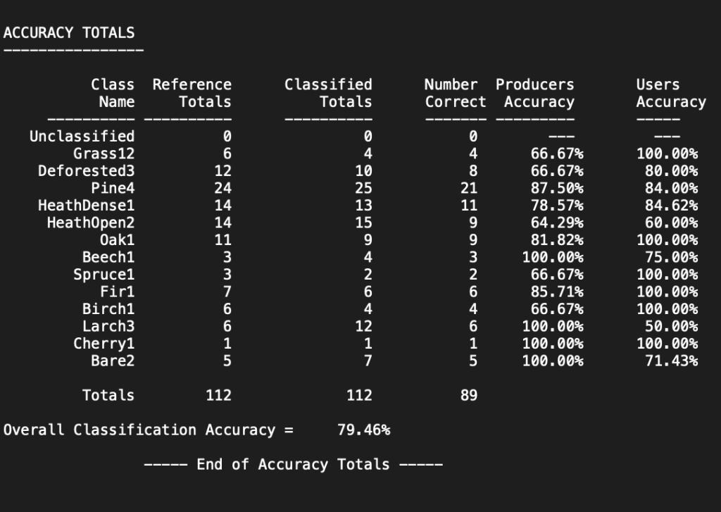
An accuracy assessment of the classifications of the different types of vegetation, showing an overall classification accuracy of 79%.